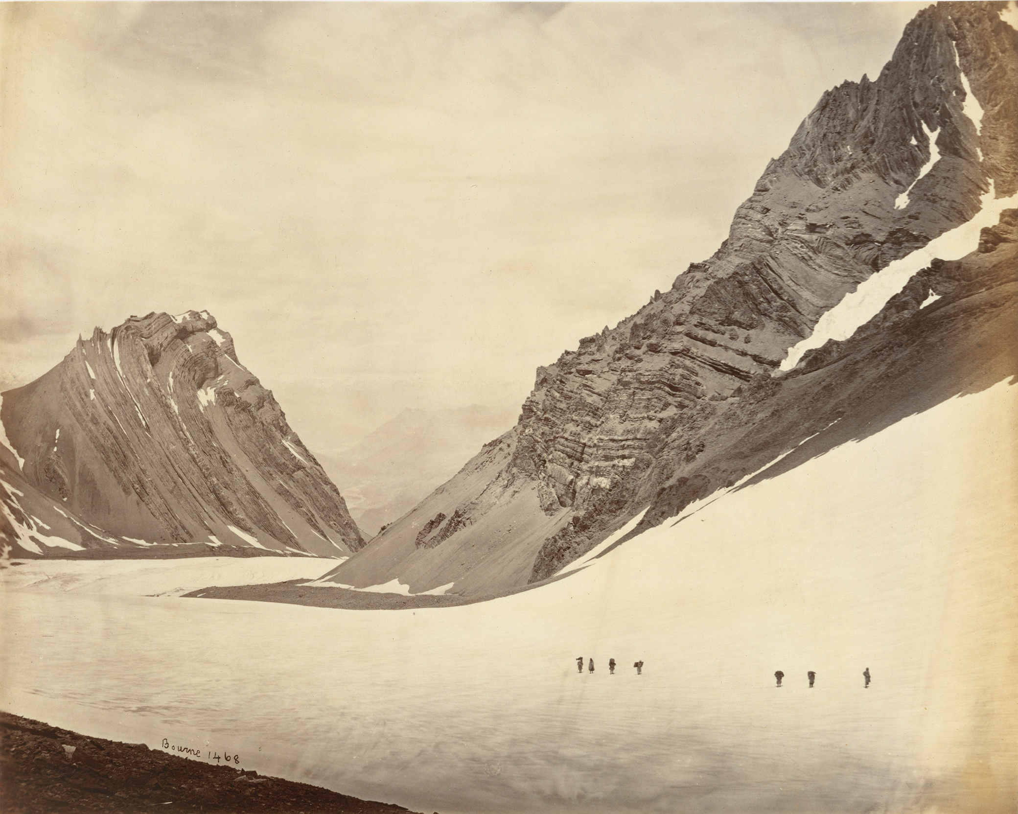
The Manirung Pass, by Samuel Bourne, 1860s. The Metropolitan Museum of Art, Gilman Collection, Purchase, Cynthia Hazen Polsky Gift, 2005.
Michael Spender had spent a year surveying and drawing up a lovingly detailed map of two tiny and remote islands off the Great Barrier Reef whose terrain consisted largely of mangrove swamp and broken bits of coral. On his return to England in 1930 he accepted a job at His Master’s Voice Gramophone Company, where he invented a way to record music that would yield better sound than their scratchy disc reproductions. When told his invention would be too expensive to engineer, he would have resigned on principle but they let him go to Paris for a month. Then he resigned. To Arthur Hinks, the secretary of the Royal Geographical Society, Michael explained that fetching and carrying for a firm quickly progressing toward Queer Street felt futile.
But what could be more futile than mapping a place with no inhabitants and no extractable resources? Unlike the Geological Survey of India project of mapping the underlying geological structure of the subcontinent in pursuit of minerals and coal, Michael’s mapping of the Barrier Reef islands, like the ongoing effort to survey and map the fifteen-hundred-mile-long chain of the Himalaya, was largely an academic exercise, though with the Himalaya there was at least the possible question of border security. It is hard to escape the feeling that the English were apt to mistake the map for the place itself. And the magical belief that maps consolidated sovereignty, accuracy equaled impartiality, and heavenly perspective mimed the eye of an imperial sovereign deity added to their irresistible allure.
In 1800 a sweet-tempered and reticent Englishman had conceived the modest ambition of surveying all of India. To map India a team of surveyors, beginning at an observatory in the eastern port of Madras, crawled toward the southernmost tip of India, before returning for a northward sweep, roughly following the arc of the seventy-eight-degree meridian. There were latitudinal forays to connect Madras and Calcutta on the east coast with Mangalore and Bombay on the west. Plagued by jungle fevers, floods, and wild animals, they steadfastly triangulated mile upon mile, year after year, using algorithms that took into account the curvature of the earth and the effect of heat on the links of the hundred-foot chain that established the seven-and-a-half-mile baselines. The longest measurement of the earth’s surface ever attempted, the result was called the Great Indian Arc of the Meridian.
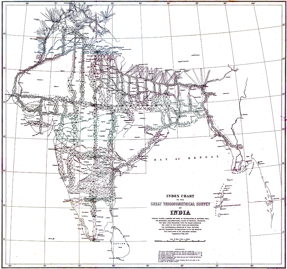
The use of triangles to estimate the distance between one point and another dates to antiquity. In order to survey a fixed area, lines of sight must first be established between three visible reference points. These three points demarcate the three points of a triangle, with the sight lines representing the three sides. The distance between two of the three points must be known. This is called the baseline. By measuring the angles made by the baseline with the angles of the sight line to a distant third point (a peak or a hill topped with a signal post), the distance and position of the latter can be established by trigonometry. Once its distance was determined, that side could be used as a baseline to fix the distance of another visible fixed point. Stations were thus added one by one, creating a web of triangles across the subcontinent. At critical junctures astronomical observations would be made to cross-check for accuracy.
For the Great Indian Arc, a theodolite weighing half a ton was used to measure the horizontal and vertical angles from each end of the seven-and-a-half-mile baseline to the fixed point. It required a dozen men to carry it. Where there was no fixed point on which to fix the telescopic sights of the theodolite, the survey team built one. Another man would see to the project’s completion, fifty years after it was begun. His name was George Everest. The highest fixed point in the world would be named after him.
A no less monumental achievement concluded half a century later. Upon winning the right to collect revenues, the East India Company had begun mapping every inch of inhabited, cultivated, and forested land in Bengal, registering the name of each landowner or tenant in logbooks. When, in response to the Indian Rebellion of 1857, the Crown bought out the company (adding its stiff price to the long column of India’s debt), the project continued. These cloth maps and logbooks were known as land records. Land records were tied in neat bundles, wrapped in red cloth, and stacked on floor-to-ceiling shelves running the length of the record room of the district collectorate. By the early twentieth century, there was a map for every village in India.
Every Indian Civil Service officer spent one cold season learning the subtleties of land settlement recording. As soon as all the villages and fields in one district were surveyed, and the names, rents, and tenures recorded, a five-member team would move on to the next. As Bengal was made up of some twenty districts and each one took from two to four years to survey, one ICS officer had calculated it would take nearly fifty years to complete one round. Then the entire operation would begin again. Aerial photography to assist in drawing maps was, however, just coming into use. A light biplane flying back and forth along three-mile strips would generate a roll of images. These flights occurred in the morning or evening so that the shadows from the low mud walls surrounding each paddy could be seen and measured.
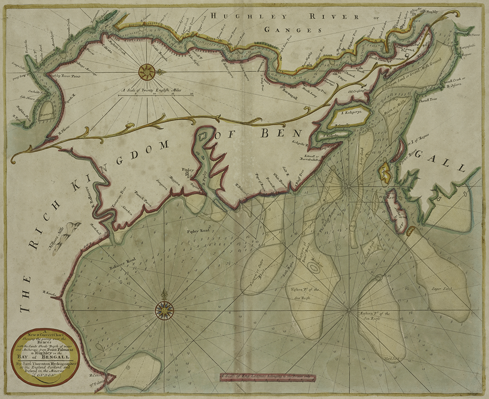
It was through land records and Survey of India maps that the Crown replaced ancient understandings governing the land with its own legalisms. The rights of hereditary ownership, from the lowliest cultivator to the most powerful landowners, could be taken away with the stroke of a patwari pen. The revised land record would then be wrapped again in red cloth and placed in the appropriate spot on the collectorate’s shelves. And there it would sit collecting dust until the land once again changed hands. Yet even the smallest village has dimensions that elude measure. The offices of the collector were often overrun with litigants, gossips, and court officers agitating for recognition of the ever-shifting tides of human affairs of which any ICS officer could only ever be dimly aware.
Tax collection in Bengal was often left in the hands of local landowners, the powerful zamindars and nawabs. On top of the revenues mandated by their British overseers, they and their minions often helped themselves to commissions, thereby sending their landless tenants spiraling into debt. The Marquis of Salisbury once said, “As India is to be bled, the lancet should be directed to those parts where the blood is congested [rather than] those which are already feeble for the want of it.”
Once the wealthiest province in all India, Bengal was bled and bled.
Michael Spender wanted to lose himself in some Sisyphean project like the Great Indian Arc. The maps of the southern African veldt were woefully inaccurate, he told Arthur Hinks. What about that? Hinks knew from the Everest Committee how difficult it was now to finance Sisyphean projects. Instead, he wrote to a Zurich professor asking that he teach Spender stereographic surveying. Hinks had Michael Spender in mind to undertake a portrait of the North Face of Everest.
The Wild stereoautograph was made of black cast iron, with a foot wheel and two handwheels. Between the hand wheels was an eyepiece with a high-powered double scope before which were placed two photographic plates. The whole apparatus was attached to a drafting table where a pencil clamped to a carriage plotted elevation lines on drafting paper, steered by the handwheels. Just beyond this contraption, Michael watched Herr Professor give a lecture about some nuance of spherical geometry while chalking an elaborate equation on a blackboard with his left fist clenched under the tail of his black frock coat.
“Good you have come here to work,” Herr Professor said, spinning around.
Switzerland’s leading expert on photogrammetry then held forth for a solid hour on the principles laid out in his opus Die Photogrammetrie und ihre Anwendung bei der schweizerischen Grundbuchvermessung und bei der allgemeinen Landesvermessung. The man’s Swiss German dialect was nearly incomprehensible, so Michael decided to read the manuscript in German, rather than use Hinks’ rough translation, so as to learn the vocabulary. He was chagrined to discover that Continental mathematicians favored meandering analytical demonstrations rather than the sort of terse proofs he was accustomed to. Within a month Michael was boasting of having mastered the false-position method and having produced an elegant proof of the rotation equation. Hinks doubtless knew what he was talking about.
It is tempting to think that drawing a topographical map is like painting a portrait. A portraitist also translates the three-dimensional features of a face to the plane of a canvas. Yet however learned in the tricks of perspective, a painter in the end will trust her eye and, depending on her skill, the face she paints will be recognizable as her sitter. A map, however, requires more than a visual comparison to check its accuracy. Its inner structure, the infrastructure of triangles brought back from the field, is concealed. Only after this framework is built can visual details be fitted onto it.
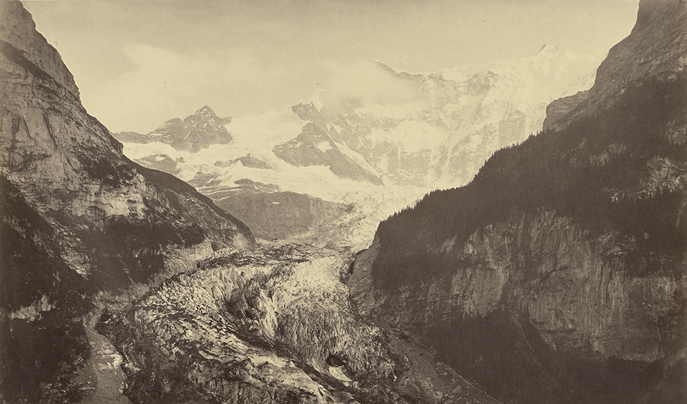
Just as painters had to rethink their art after the arrival of photography, so did mapmakers. The algorithms used to account for distortion and calculate scale from photographs made for laborious computations. A black box was needed to automate them. The first was invented in 1901; the Wild (pronounced Vilt) was the latest iteration. Photogrammetry, the craft of making measurements from photographs, thus became the art of avoiding mind-bending computation so as to master the art of detailing the contours of distant surfaces, such as mountains, from photographs. Using aerial and terrestrial photography, the Swiss had spent the past five years remapping all of Switzerland.
As the Alps constituted about half of the country, the Swiss had a head start on the new technique of stereophotogrammetry, one ideally suited for mountainous terrain. In this technique, instead of a single photograph, a pair of photographs was used. Each photograph of a fixed point on a summit was taken from a slightly different base on the ground. By adjusting the left and right handwheels of the Wild the two images merged and suddenly the mountain would jump into three dimensions in the view finder.
This physiological phenomenon affected the geometry inasmuch as it was suddenly possible to identify and plot more accurately every feature of the visible terrain. But it also required an illustration method that could convey an illusion of depth, without overwhelming the map with useless or distracting detail. A subtle sense of light and shade, Michael saw, enabled Swiss mapmakers to differentiate between rock and scree, between snow field and glacier; it was a perfect marriage of art and the scientific method. The Swiss mastery of Felszeichnung, mountain portraiture, accounted for the popularity of prewar Swiss maps. Like the features of a human face, a skillful rendering of weathered rock, even the way its strata were arranged, gave each mountain face its individuality, its profile. After mastering Felszeichnung, Michael left for the Alps to photograph the mountains themselves.
Of course the mere idea of getting out of a sleeping bag an hour before dawn made him feel he was taking a ridiculous pursuit far too seriously. A cup of tea eased him past this. Together with his small team, Michael would begin to climb. If he let himself attain full consciousness the pace was unbearable, so he maintained a trancelike reverie, letting his mind wander as his boots beat out a rhythm over the frozen moraine. If he was hungry, the relentless, drumming thought of food became tedious. Even worse was having someone along who insisted on talking. Michael tended to choose the lowest mountains for his stations, ones that would give him sufficient observations but wouldn’t be too difficult to climb.
At dawn, having reached over eleven thousand feet, he would call a halt. The damp patch at the small of his back beneath his rucksack would go instantly cold as the peak of the massif in front of him attained a rosy glow. He would then suit up and slather his face with cream to protect it from the sun. One of his assistants would unrope and cross to the next ridge with the target mark and two-meter rule. To distract himself from the cold, Michael would estimate the distance and the time it would take his assistant to get there. Using a hammer and chisel to prepare a foothold, he would then remove the tripod from its case and plant it on the ground.
By the time the phototheodolite was set up, the yellow light that lay across the snowy peaks would tell him the sun was high enough to begin. A dark eyepiece was fixed and pointed at the sun to establish the longitude. While one of his assistants held an umbrella over his head, Michael would inform his booker that he was first going to take the sun’s lower limb, by which he meant the lower edge of the disk. But since in the telescope everything was upside down, it was actually the upper one. When the sun reached the cross wires in the theodolite, he shouted “UP” and the booker noted down the time on his watch to the nearest half second. Then he read him the vertical angle. Twelve such observations completed the morning sights. After checking the angles twice, Michael took a photograph.
Without a set routine, the hurry to get to work might cause some small slip in the setting of the swing or the observation of the spirit levels. While this might not render the work invalid, accuracy and efficiency were Michael’s bywords.
At noon the latitude was taken. After that he would sit down and tear into a tin of sardines while his assistants finished building a cairn over the spot where the tripod had been. The empty tin would be buried in the cairn and a final stone placed on top. That day’s station, combined with the day before’s and the next day’s, would provide the three corners of a triangle. A fourth station taken the day after the next would, with the two previous, extend the network further. Eventually a latticework of triangles would overlie the area to be mapped. The Great Arc had progressed in exactly this manner.
In the early afternoon Michael would set up a detail station, choosing a spot in front of a prominent peak. Later, he would cross the glacier and ascend to the other side of the valley to take a photograph of the same fixed point from another base, leaving the phototheodolite behind under a tarp for the next day. Long before the sun set Michael would be back at the hut for a cup of Maggi soup and an early night.
Excerpted from The Last Englishmen: Love, War, and the End of Empire by Deborah Baker. Copyright © 2018 by Deborah Baker. Reprinted with the permission of Graywolf Press, Minneapolis, Minnesota.
